| Brief |
| Purpose |
| Motivation |
| Advantage |
| Organization |
| Staff |
| Contact us |
|
|
|
|||||||||||||||||||||||||||||||||||||
 |
|
|
Light Detection And RangingData:[2017-12-22] Source:
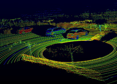
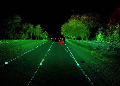
Lidar (also called LIDAR, LiDAR, and LADAR) is a surveying method that measures distance to a target by illuminating that target with a pulsed laser light, and measuring the reflected pulses with a sensor. Differences in laser return times and wavelengths can then be used to make digital 3D-representations of the target. The name lidar, sometimes considered an acronym of Light Detection And Ranging(sometimes Light Imaging, Detection, And Ranging), was originally a portmanteau of light and radar. Lidar is commonly used to make high-resolution maps, with applications in geodesy, geomatics, archaeology, geography, geology, geomorphology, seismology, forestry, atmospheric physics,laser guidance, airborne laser swath mapping (ALSM), and laser altimetry. The technology is also used for control and navigation for some autonomous cars. Lidar sometimes is called laser scanning and 3D scanning, with terrestrial, airborne, and mobile applications.
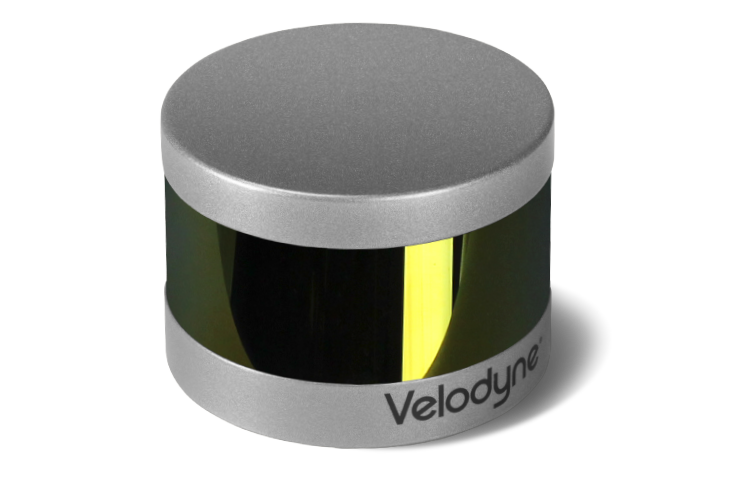
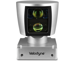
PUCK™ VLP-16 Velodyne's PUCK™ VLP-16 sensor is the smallest, newest and most advanced production Velodyne's 3D LiDAR product range. Vastly more cost-effective than similarly priced sensors and developed with mass production in mind, it retains the key features of Velodyne's breakthroughs in LiDAR: Real-time, 360°, 3D distance and calibrated reflectivity measurements. The VLP-16 has a range of 100m, and the sensor's low power consumption (~8W), light weight (500 gram or 830 gram options available), compact footprint (~Ø103mm x 72mm), and dual return capability make it ideal for UAVs and other mobile applications. Velodyne’s LiDAR Puck supports 16 channels, ~300,000 points/sec, a 360o horizontal field of view and a 30o vertical field of view, with /- 15o up and down. The Velodyne LiDAR Puck does not have visible rotating parts, making it highly resilient in challenging environments (Rated IP67).
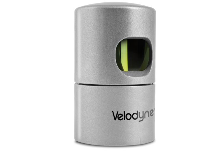
HDL-32E The HDL-32E LiDAR sensor is small, lightweight, ruggedly built and features up to 32 lasers across a 40o vertical field of view. The HDL-32E measures only 5.7" high x 3.4" in diameter, weighs less than two kilograms and was designed to exceed the demands of the most challenging real-world autonomous navigation, 3D mobile mapping and other LiDAR applications.
HDL-64E S3 The HDL-64E LiDAR sensor is designed for obstacle detection and navigation of autonomous ground vehicles and marine vessels. Its durability, 360o field of view and very high data rate makes this sensor ideal for the most demanding perception applications as well as 3D mobile data collection and mapping applications. The HDL-64E's innovative laser array enables navigation and mapping systems to observe more of their environment than any other LiDAR sensor.
Next:Analyzer |


|